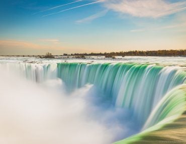
Are you visiting Toronto and want to know some of the best spots for viewing and capturing the city’s skyline? In this post I will tell you the best spots and viewpoints that I have found, and further below you’ll find some photography tips for taking pictures of the skyline. All these suggestions are places that you can access for free, or by paying entry. You may see other more unique angles online, but these may be from private locations where photographers have gained access to that photo spot, with or without permission. I personally think Toronto needs to do more to provide more accessible high spots, such as rooftop bars and observation decks. However, besides the CN Tower or taking a helicopter tour, it’s quite hard to find many good aerial locations.
So want to know the best places around the city for your pictures? Below are the best views and spots around the city to capture the Toronto skyline.
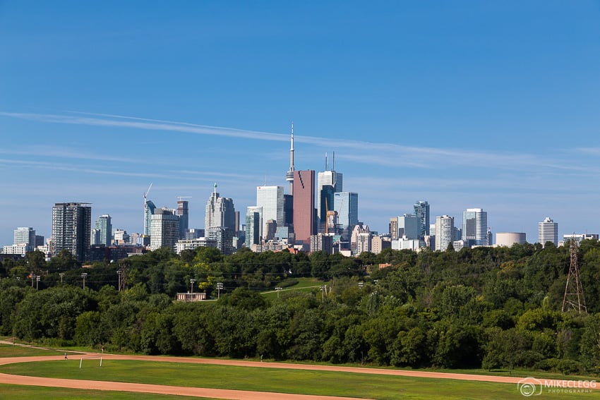
1. Riverdale Park East
Riverdale Park East is a fantastic location in Toronto to see the skyline. The park is one of my favourite locations in the city and one thing I particularly like about this viewpoint is that in the foreground you have a hill that overlooks a running track and a baseball cage (not in my shot below). These add interesting elements to photographs. It’s also nice to sit and just watch people on the track or playing baseball with the skyline in the background.
During the winter you may see snow on the trees and the field, and from the hill (where the below photograph was taken) people may even be sledging down which is pretty cool to see (and take part in).
The view below is slightly east of downtown. The quickest way to get here is to get off at Broadview subway station and then take a tram south or walk for around 5 mins from the station.
Best time: Morning/sunset/blue hour
Cost: Free
Where is this? See location/directions on Google Maps
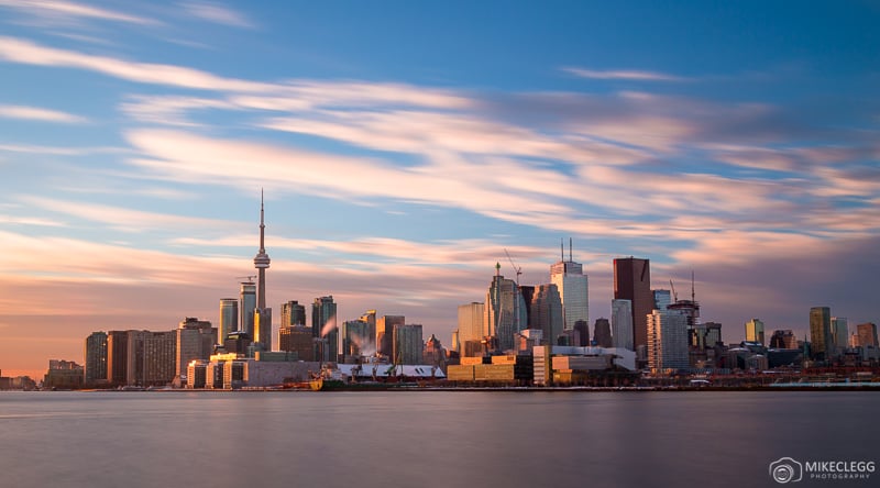
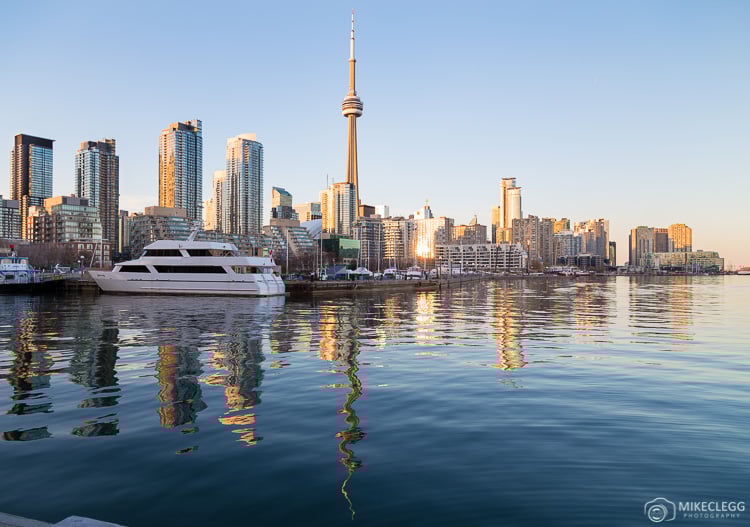
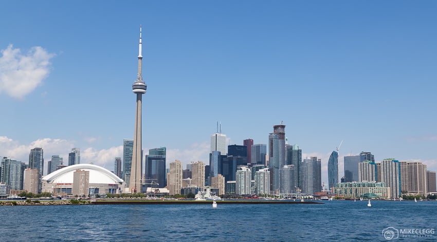
2. Views from a boat
A great way to see and enjoy the Toronto skyline is from a boat cruise. You’ll find various options that depart from the harbours at the waterfront and then venture out into Lake Ontario and around the Toronto Islands. These are perfect for seeing the Toronto skyline and allow you to sit back and relax whilst gazing towards the city. These allow you to capture images or just view the skyline from various angles from one of Canada’s Great Lakes. Here is a popular cruise option that you may enjoy.
3. Humber Bay
A great place for a walk and to see and enjoy the skyline is from Humber Bay. Along this area of the lake, which is west of downtown, you’ll find a boardwalk and beach area. Further along, there is an arched bridge and from that area is a great location for taking pictures or just sitting down and relaxing with the view. For those who want to get nice sunrise shots this is one of the best spots as the sun often rises behind the city.
Best time: Sunrise/morning
Where is this? See location/directions on Google Maps
Cost: Free
4. Trillium Park
Trillium Park is one of the city’s newest parks and is quite downtown, but slightly west and jutting out into Lake Ontario. From here you can relax and enjoy views over the city including the CN Tower and many skyscrapers. Views of the city do look nice both day and night, although at night it is especially nice when the skyline lights up.
Best time: All times of day
Where is this? See location/directions on Google Maps
Cost: Free
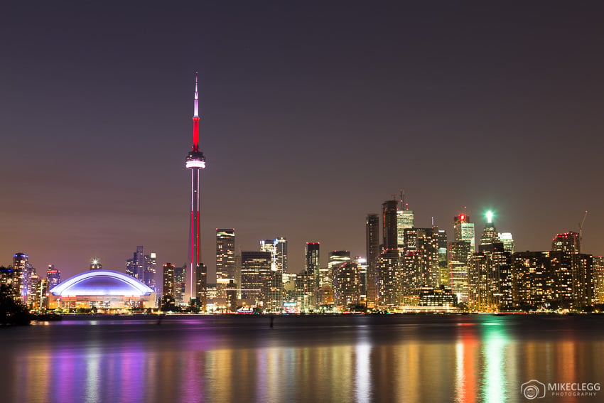
5. The CN Tower
The CN Tower is one of the city’s most iconic and well-known attractions. It is also one of the world’s most impressive towers. The main observation deck is located at 346 meters and there is also an even higher deck at 447 meters (the Skypod). Being so high these observation decks serve as some of the best spots to see and take pictures of the Toronto skyline. It’s a paid viewpoint but definitely worth it and a nice experience. Heading up the tower is one of the best things to do in Toronto with the family as well.
Best time: Sunset/blue hour
Where is this? See location/directions on Google Maps
Cost: Ticketed – see cntower.ca
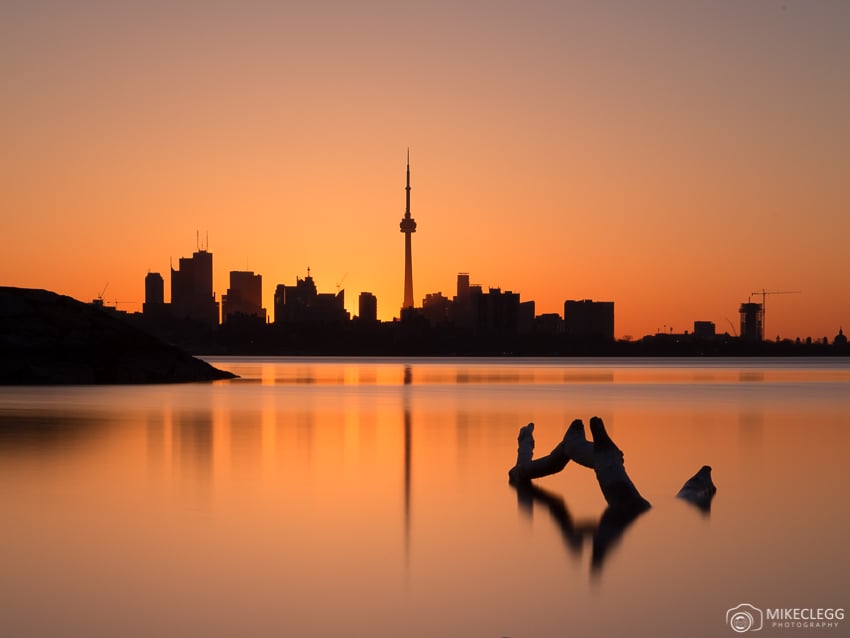
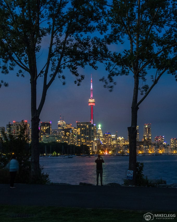
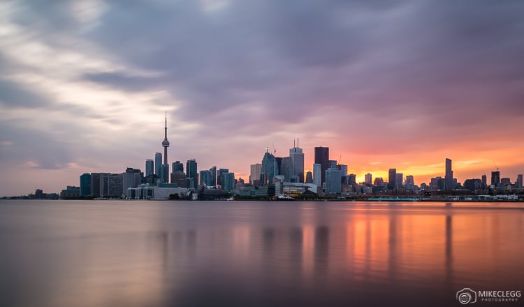
6. Ireland Park
The Ireland Park is towards the city’s waterfront and offers a side view of the city. The water of Lake Ontario can be particularly still here at times where you may capture reflections photographs such as below. You can also visit this location in the winter when there’ll be ice on the lake which is sometimes very reflective, or a bit cracked adding a different perspective.
From Ireland Park, you’ll find lots of benches where you can relax and enjoy the city as the sun goes down and it starts lighting up, including the CN Tower with its wonderful colours.
Best time: Sunset/blue hour
Where is this? See location/directions on Google Maps
Cost: Free
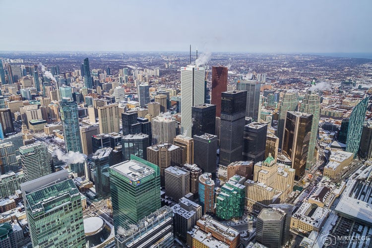
7. A helicopter tour
For a unique perspective consider taking a helicopter tour. These go pretty quick so make sure you have your camera set up and ready before you board, such as a fast enough shutter speed to accommodate the speed of the moving helicopter. Of course try and enjoy the views of Toronto too, and not just take pictures.
Best time: Anytime
8. Polson Pier
Slightly to the east of the city you’ll find Polson Pier. This is one of the classic viewpoints and provides an awesome perspective all year round, including in the winter. You can get here by public bus, drive, or Uber. If you visit in the winter, make sure you wrap up warm, and I mean really warm as the wind can be ice cold!
Note that this location may no longer be accessible due to construction.
Best time: Sunset and blue hour
Where is this: Location/directions on Google Maps (Head to the park at the end of Polson Street)
Cost: Free
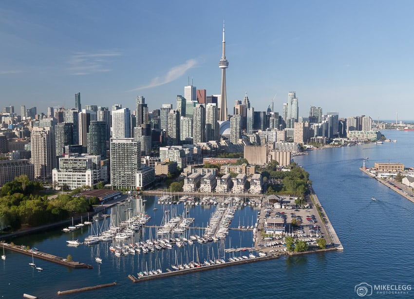
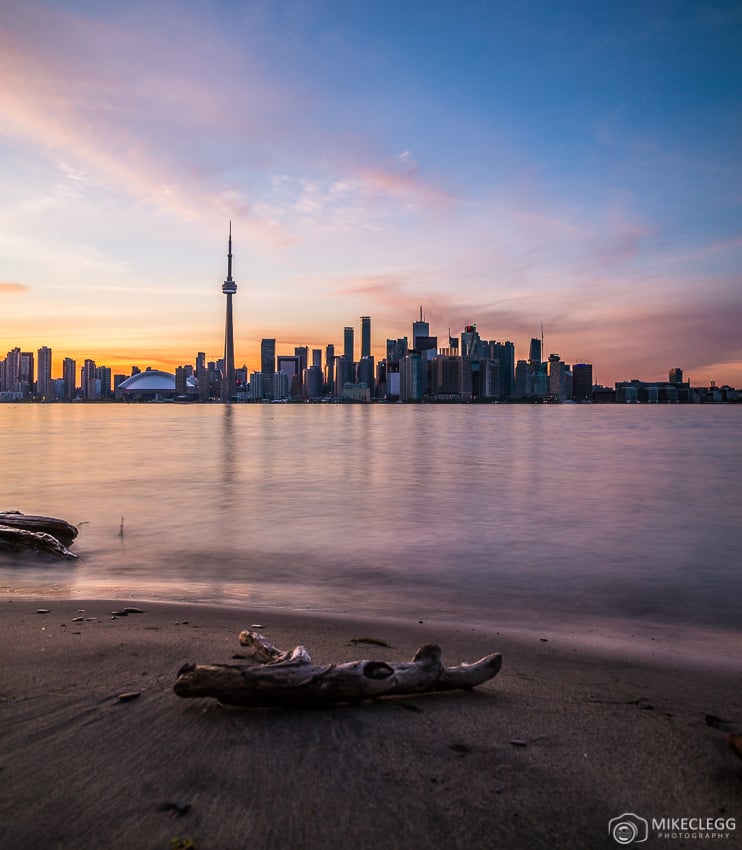
9. The Toronto Islands
One of the best and also the most popular places to capture the skyline is to head over to the Islands. By taking the ferry you can get off at either Ward’s, Centre or Hanlan’s Islands, and all of them offer a slightly different view. Read our guide and tips on visiting the Toronto Islands.
9.1 Centre Island
Centre Island is one of the most popular spots facing directly in front of the city. Once you get off the ferry head to Olympic Island where you’ll find lots of places to enjoy the Toronto skyline. Also, nearby you’ll find the Centreville Theme Park and directly on the other side (away from the city) is a beach which is great in the summer.
Best time: Sunset/blue hour
Where is this? See location/directions on Google Maps
Cost: Ferry ticket
9.2 Ward’s Island
This island is towards the east and provides a slight angle of the city. You’ll also find small houses here for the people that live on the Island. This particular spot also has a small beach facing towards the city which is great to add into your shots too.
Best time: Sunset/blue hour
Where is this? See location/directions on Google Maps
Cost: Ferry ticket
9.3 Hanlan’s Island
Hanlan’s Island isn’t the best view of the city, although it’s still nice to visit if you have time. If you like walking you could get off the ferry at this point and then walk round to Centre and Olympic Island, although it may take around an hour!
Best time: Sunset/blue hour
Where is this? See location/directions on Google Maps
Cost: Ferry ticket
Discover top activities, tours and experiences below:
My Toronto skyline photography tips
- Consider getting up early to capture the skyline at sunrise, or alternatively try capturing it at sunset. For techniques head to Photography Tips -Shooting in the Golden Hour.
- Taking pictures of the skyline at night will give you some of the best photographs. During this time the city lights up and when taken with a long exposure you should be able to capture beautiful shots.
- Consider using an ND filter to smooth water and create streaky clouds.
- Try and use foregrounds to add depth to your images.
- Use Adobe Lightroom and possibly photography presets to quickly and easily enhance your images.
For more techniques for capturing skylines head to Photography Tips – Techniques for Capturing City Skylines
Summary
These are some of the top locations to see the Toronto skyline. From these places, you’ll get to enjoy the city and capture some great pictures and memories along the way.